2022-2023 USAP Field Season
Project Detail Project Title88S traverse: GPS survey for calibration and validation of ICESat-2 altimetry data Summary
Event Number:
Program Director:
ASC POC/Implementer: Principal Investigator(s)
Dr. Tom Allen Neumann
Location
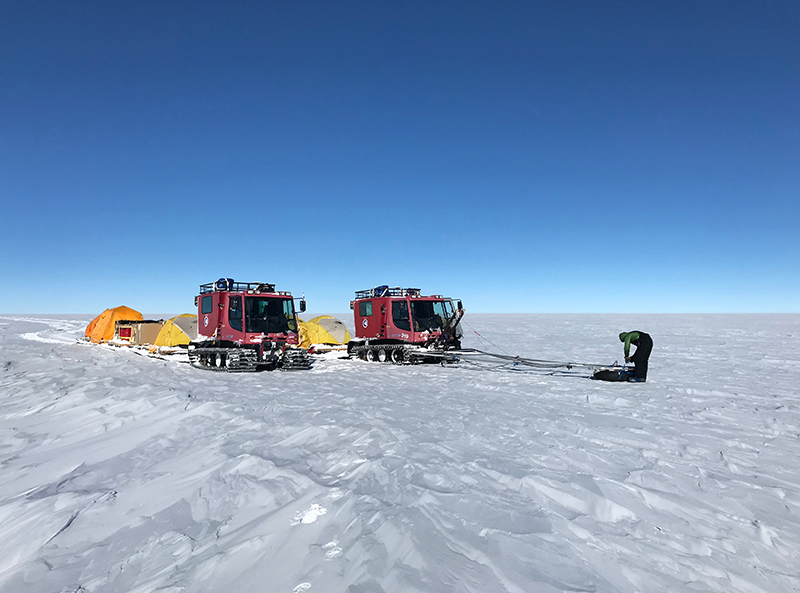
Supporting Stations: McMurdo Station, South Pole Station DescriptionThis project conducts a high-precision GPS survey, based out of South Pole Station, along a 300 km segment of the 88 degrees south line-of-latitude. The goal is to produce a large-scale dataset for the calibration of airborne and space-borne altimetry, and to validate ICESat-2 elevation measurements. The traverse along the ICESat-2 ground track convergence zone represents the only large-scale, ice-based validation effort on a cold, relatively stable part of the ice-sheet interior. Field Season OverviewThis science event is the third PistenBully traverse associated with a ground-based GPS survey for the validation of NASA's ICESat-2 elevation and elevation change data products. The 750 kilometer traverse route is along the 87.979° S line of latitude, approximately 224 kilometers from the South Pole. The traverse will have two NASA participants, one ASC mountaineer, and one Antarctic Support Contract (ASC) mechanic. Participants will spend one week at McMurdo Station to gather field gear and attend training before moving on to South Pole Station. Once at South Pole Station, the team will acclimatize and prepare the two PistenBully vehicles and sled platforms for the traverse. Each vehicle will have a GPS receiver operating at all times, with a third GPS antenna and receiver available for instrument redundancy. The team will collect GPS data and reoccupy their deployed LiDAR cornercube reflectors. The traverse is estimated to take approximately 15 days to complete. Deploying Team Members
|
2022-2023 Science Planning Summary

For USAP Participants |
For The Public |
For Researchers and EducatorsContact UsU.S. National Science FoundationOffice of Polar Programs Geosciences Directorate 2415 Eisenhower Avenue, Suite W7100 Alexandria, VA 22314 Sign up for the NSF Office of Polar Programs newsletter and events. Feedback Form |

:")
